South River Falls Trail
Distance:
1.4 Miles / 2.3 kmType:
One-WayDifficulty:
HardTime to Hike:
~42 minutesFeatures:
Surface Type:
DirtLoading...
Loading...
This is a great trail in Shenandoah National Park, but is pretty difficult given the change in elevation. It's at least 2.8 miles out-and-back if you take the same trail. Or you can extend the hike to 3.3 miles by taking the South River Fire Rd Trail back (recommended).
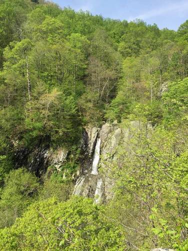
The trail has a fairly steep grade downhill for the first 0.7 miles (including switchbacks). Once you get to the bottom of the switchbacks, the trail runs along the South River for about 0.7 miles until you reach the waterfall overlook.
I suggest taking the South River Fire Rd Trail back to the parking area (2 miles one-way) since it's less steep than this one on; however, it's a slightly longer journey.
Bring lots of water and plan to hike at least 2.8 miles out-and-back.
Hazards
Season
SpringBlaze Color
2 Trip Reports


Helpful Links
Find Hiking Trails Near Me:


Before you leave...
MyHikes is an indie web platform aimed to make exploring public trails easier for everyone. The site has no investors and is owned and operated by one person, Dave Miller (Founder & Admin). As the Founder, main contributor, and doer-of-all-things for MyHikes, I share my trips with over-detailed write-ups for fun on a volunteer basis and I believe that public trail information should be available to everyone.
It takes a lot of time 🕦, money 💰, and effort (including espresso shots ☕) to run MyHikes, including hiking , mapping , writing , and publishing new trails with high-quality content... along with building new features, moderating, site maintainance, and app development for iOS and Android . I simply ask that if you find MyHikes' trail guides helpful to please consider becoming a Supporter to help keep the site, iOS, and Android apps available to everyone.
Supporters unlock website and in-app perks with a one-time payment of $25 (you renew) 😎👍. Or you can simply make a Donation of your choice without a MyHikes user account. Otherwise, telling your friends about MyHikes is the next-best thing - both quick and free 🎉
Thanks for visiting MyHikes and have a great hike!️

Dave Miller
MyHikes Founder & Admin

