Rock House Gorge Trail
Distance:
1.2 Miles / 1.9 kmType:
Out-and-BackDifficulty:
ModerateTime to Hike:
~36 minutesFeatures:
Surface Type:
DirtLoading...
Loading...
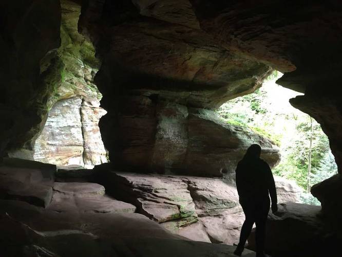
This 0.6 mile one-way trail (1.2 out-and-back) leads down to the Rock House cave at Hocking Hills State Park, Ohio. The trail also runs alongside the rock house cliffs before heading back up to the parking lot. You'll find waterfalls trickling down on both sides of the rock house cave formation.
In the middle of the trail is the rock house - a cave that's about 15-20 feet deep and about 200 feet long. The cave has large openings facing outward from the cliff side so you can enter it in various points along this trail.
It's definitely a unique trail and a must-visit at Hocking Hills State Park if you're in the area.
Pets are not allowed on this trail.
Season
SpringBlaze Color
3 Trip Reports


Helpful Links
Find Hiking Trails Near Me:


")


Before you leave...
MyHikes is an indie web platform aimed to make exploring public trails easier for everyone. The site has no investors and is owned and operated by one person, Dave Miller (Founder & Admin). As the Founder, main contributor, and doer-of-all-things for MyHikes, I share my trips with over-detailed write-ups for fun on a volunteer basis and I believe that public trail information should be available to everyone.
It takes a lot of time 🕦, money 💰, and effort (including espresso shots ☕) to run MyHikes, including hiking , mapping , writing , and publishing new trails with high-quality content... along with building new features, moderating, site maintainance, and app development for iOS and Android . I simply ask that if you find MyHikes' trail guides helpful to please consider becoming a Supporter to help keep the site, iOS, and Android apps available to everyone.
Supporters unlock website and in-app perks with a one-time payment of $25 (you renew) 😎👍. Or you can simply make a Donation of your choice without a MyHikes user account. Otherwise, telling your friends about MyHikes is the next-best thing - both quick and free 🎉
Thanks for visiting MyHikes and have a great hike!️

Dave Miller
MyHikes Founder & Admin

