Orange & Green Dot Trail
Distance:
1.4 Miles / 2.3 kmType:
Out-and-BackDifficulty:
EasyTime to Hike:
~42 minutesFeatures:
Surface Type:
DirtLoading...
Loading...
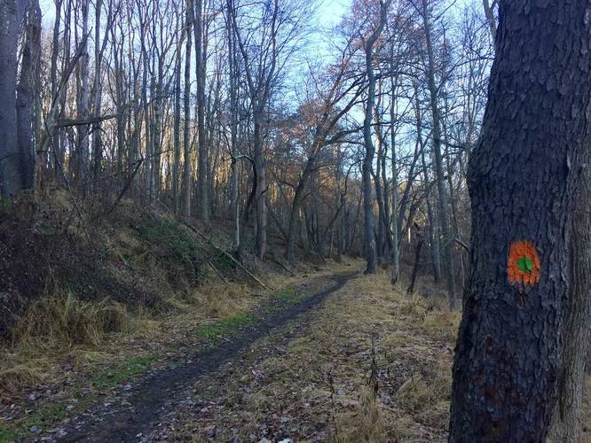
The Orange & Green Dot Trail at North Park in Allison Park, Pennsylvania is an easy 1.4 mile out-and-back hike that runs along the west side of the park. The trail itself runs directly along Kummer Rd for about 0.7 miles and starts at the North Park Scout Cabin Shelter. You can park directly at the Scout Cabin Shelter and walk to the end of the parking lot rd to Kummer Rd - directly across the street is the trailhead with two posts - both have the Orange & Green Dot blazes.
The trail is flat but heads uphill if you're hiking south to north. The trail ends again on Kummer Rd only after you hike down Hilltop Diver. Once you hit Hilltop Drive, you'll notice the blazes continue down the road on the trees until you reach Kummer Rd.
Sights: The only interesting thing to see on this trail is the Fountain of Youth across the street. Definitely check out the Fountain of Youth on your way back as this is a unique rock grotto that resembles something out of Lord of the Rings.
Dogs and biking are allowed on this trail.
Hazards
Seasons
AllBlaze Color
Blaze Dot
2 Trip Reports


Before you leave...
MyHikes is an indie web platform aimed to make exploring public trails easier for everyone. The site has no investors and is owned and operated by one person, Dave Miller (Founder & Admin). As the Founder, main contributor, and doer-of-all-things for MyHikes, I share my trips with over-detailed write-ups for fun on a volunteer basis and I believe that public trail information should be available to everyone.
It takes a lot of time 🕦, money 💰, and effort (including espresso shots ☕) to run MyHikes, including hiking , mapping , writing , and publishing new trails with high-quality content... along with building new features, moderating, site maintainance, and app development for iOS and Android . I simply ask that if you find MyHikes' trail guides helpful to please consider becoming a Supporter to help keep the site, iOS, and Android apps available to everyone.
Supporters unlock website and in-app perks with a one-time payment of $25 (you renew) 😎👍. Or you can simply make a Donation of your choice without a MyHikes user account. Otherwise, telling your friends about MyHikes is the next-best thing - both quick and free 🎉
Thanks for visiting MyHikes and have a great hike!️

Dave Miller
MyHikes Founder & Admin

