M & M Trail - Harris Mtn Rd to Federal St
Distance:
4.0 Miles / 6.4 kmType:
Out-and-BackDifficulty:
ModerateTime to Hike:
2 hoursFeatures:
Surface Type:
DirtTown:
Granby, MassachusettsLoading...
Loading...
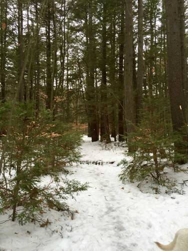
This small section of the M & M trail is a 4 mile out-and-back hike from Mt Harris Rd in Granby, MA over toward Federal St in Belchertown, MA.
The hike is fairly moderate considering there are multiple uphill climbs and a steep grade going downhill toward Bay Rd. When you reach Bay Rd, hike south along the eastern side of the road until you see the white blazes again, just before the turn to Old Bay Rd. The trail will continue uphill for a short while before heading back downhill toward Federal St.
The GPS data only goes about 1/2 way from Bay Rd over to Federal St. Follow the white blazes.
Hazards
Seasons
AllBlaze Color
1 Trip Report


Helpful Links
Find Hiking Trails Near Me:


Before you leave...
MyHikes is an indie web platform aimed to make exploring public trails easier for everyone. The site has no investors and is owned and operated by one person, Dave Miller (Founder & Admin). As the Founder, main contributor, and doer-of-all-things for MyHikes, I share my trips with over-detailed write-ups for fun on a volunteer basis and I believe that public trail information should be available to everyone.
It takes a lot of time 🕦, money 💰, and effort (including espresso shots ☕) to run MyHikes, including hiking , mapping , writing , and publishing new trails with high-quality content... along with building new features, moderating, site maintainance, and app development for iOS and Android . I simply ask that if you find MyHikes' trail guides helpful to please consider becoming a Supporter to help keep the site, iOS, and Android apps available to everyone.
Supporters unlock website and in-app perks with a one-time payment of $25 (you renew) 😎👍. Or you can simply make a Donation of your choice without a MyHikes user account. Otherwise, telling your friends about MyHikes is the next-best thing - both quick and free 🎉
Thanks for visiting MyHikes and have a great hike!️

Dave Miller
MyHikes Founder & Admin

