Jennings Trail
Distance:
1.7 Miles / 2.7 kmType:
One-WayDifficulty:
ModerateTime to Hike:
~51 minutesFeatures:
Surface Type:
DirtLoading...
Loading...
The Jennings Trail at Raccoon Creek State Park's Wildflower Reserve is a moderate 1.7-mile one-way trail that leads from the parking lot and passes through the largest portion of the wildflower reserve before ending at the Henrici Trail. You can take the Henrici Trail back for a 2.3-mile loop hike.
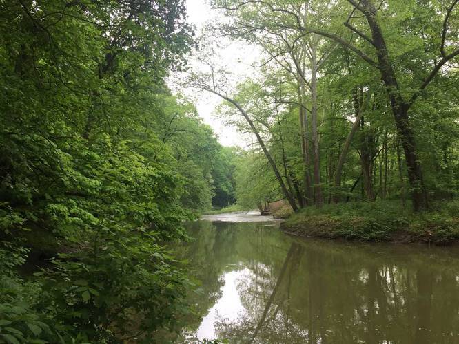
This trail starts at the southern end of the parking lot and heads downhill towards Raccoon Creek and then follows the creek for about a mile. The trail is often muddy, especially during the Spring.
You'll get views of rock ledges, Raccoon Creek, wildflowers, and a small cabin along the way.
No dogs, biking, or food allowed on the trails within the wildflower reserve.
Hazards
Seasons
AllBlaze Color
3 Trip Reports


")


Before you leave...
MyHikes is an indie web platform aimed to make exploring public trails easier for everyone. The site has no investors and is owned and operated by one person, Dave Miller (Founder & Admin). As the Founder, main contributor, and doer-of-all-things for MyHikes, I share my trips with over-detailed write-ups for fun on a volunteer basis and I believe that public trail information should be available to everyone.
It takes a lot of time 🕦, money 💰, and effort (including espresso shots ☕) to run MyHikes, including hiking , mapping , writing , and publishing new trails with high-quality content... along with building new features, moderating, site maintainance, and app development for iOS and Android . I simply ask that if you find MyHikes' trail guides helpful to please consider becoming a Supporter to help keep the site, iOS, and Android apps available to everyone.
Supporters unlock website and in-app perks with a one-time payment of $25 (you renew) 😎👍. Or you can simply make a Donation of your choice without a MyHikes user account. Otherwise, telling your friends about MyHikes is the next-best thing - both quick and free 🎉
Thanks for visiting MyHikes and have a great hike!️

Dave Miller
MyHikes Founder & Admin

