Hemlock Trail
Distance:
1.8 Miles / 2.9 kmType:
Out-and-BackDifficulty:
EasyTime to Hike:
~54 minutesFeatures:
Surface Type:
DirtLoading...
Loading...
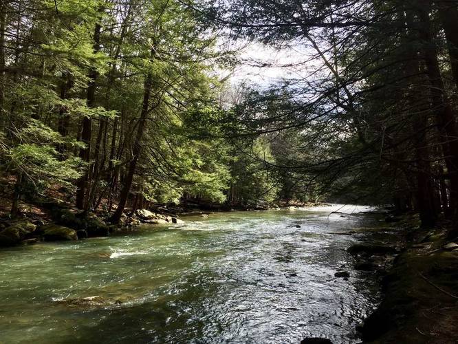
The Hemlock Trail in Laurel Hill State Park, PA, is an easy 1.8 mile out-and-back hike that leads you through an old growth Hemlock grove.
The trail runs from the parking lot on Laurel Hill Park rd next to Laurel Hill Creek over to Buck Run rd in Laurel Hill State Park.
You can fish along the creek as well and it's stocked with trout, but you need to use artificial lures per regulations and of course, need a state license.
The GPS data provided is missing the southern/western trail split section - you can technically take 2 routes to/from the trailheads. Follow the yellow blazes to stay on route.
Old Growth Grove: The old growth forest can be found within the 'loop' portion of this trail data, which is about 0.5 miles from the start of the hike. You'll find signs that clearly distinct that section of the forest as the old growth area.
Biking is not allowed through this trail.
Hazards
Season
WinterBlaze Color
2 Trip Reports


Helpful Links
Find Hiking Trails Near Me:


Before you leave...
MyHikes is an indie web platform aimed to make exploring public trails easier for everyone. The site has no investors and is owned and operated by one person, Dave Miller (Founder & Admin). As the Founder, main contributor, and doer-of-all-things for MyHikes, I share my trips with over-detailed write-ups for fun on a volunteer basis and I believe that public trail information should be available to everyone.
It takes a lot of time 🕦, money 💰, and effort (including espresso shots ☕) to run MyHikes, including hiking , mapping , writing , and publishing new trails with high-quality content... along with building new features, moderating, site maintainance, and app development for iOS and Android . I simply ask that if you find MyHikes' trail guides helpful to please consider becoming a Supporter to help keep the site, iOS, and Android apps available to everyone.
Supporters unlock website and in-app perks with a one-time payment of $25 (you renew) 😎👍. Or you can simply make a Donation of your choice without a MyHikes user account. Otherwise, telling your friends about MyHikes is the next-best thing - both quick and free 🎉
Thanks for visiting MyHikes and have a great hike!️

Dave Miller
MyHikes Founder & Admin

