H. H. Jackson to Robert Frost Spur Trail
Distance:
0.2 Miles / 0.3 kmType:
One-WayDifficulty:
EasyTime to Hike:
~6 minutesFeatures:
Surface Type:
DirtLoading...
Loading...
This tiny connector trail at the Puffer's Pond Conservation Area in Amherst, Massachusetts is a 0.2 mile one-way hike that connects the top of the H. H. Jackson Trail to the Robert Frost Trail and is an easy way to wrap up a short loop hike at Puffer's Pond. At the beginning of this trail is a small overlook, during colder months, when no leaves are on the trees; however, it's nothing special. You can see UMass and the Holyoke Range through the trees before heading downhill towards the Robert Frost Trail. There are no blazes to follow.
You can also park on Pulpit Hill Road where the H. H. Jackson Trail ends/begins.
-
Parking
42.416095, -72.514826 -
Main Trailhead
42.418449, -72.517549 -
Obstructed view of the Holyoke Range in the distance
42.418433, -72.517525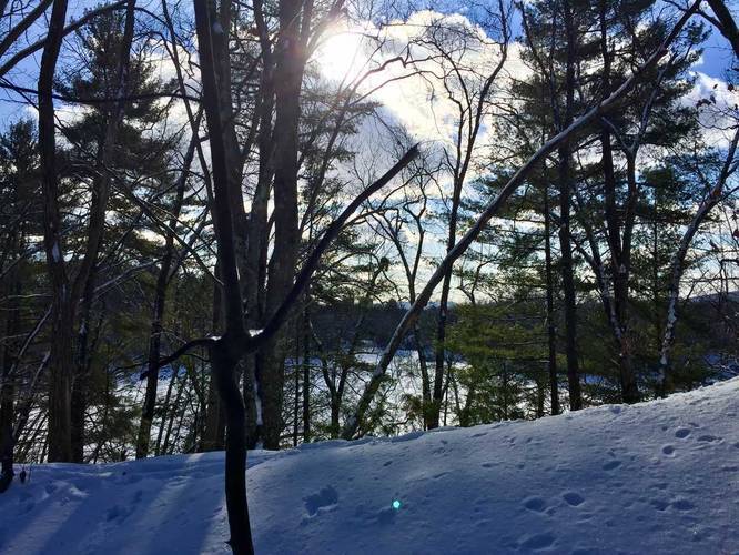
Hazards
Seasons
All
2 Trip Reports


Helpful Links
Find Hiking Trails Near Me:


Before you leave...
MyHikes is an indie web platform aimed to make exploring public trails easier for everyone. The site has no investors and is owned and operated by one person, Dave Miller (Founder & Admin). As the Founder, main contributor, and doer-of-all-things for MyHikes, I share my trips with over-detailed write-ups for fun on a volunteer basis and I believe that public trail information should be available to everyone.
It takes a lot of time 🕦, money 💰, and effort (including espresso shots ☕) to run MyHikes, including hiking , mapping , writing , and publishing new trails with high-quality content... along with building new features, moderating, site maintainance, and app development for iOS and Android . I simply ask that if you find MyHikes' trail guides helpful to please consider becoming a Supporter to help keep the site, iOS, and Android apps available to everyone.
Supporters unlock website and in-app perks with a one-time payment of $25 (you renew) 😎👍. Or you can simply make a Donation of your choice without a MyHikes user account. Otherwise, telling your friends about MyHikes is the next-best thing - both quick and free 🎉
Thanks for visiting MyHikes and have a great hike!️

Dave Miller
MyHikes Founder & Admin

