Glade Creek Trail
Distance:
12.2 Miles / 19.6 kmType:
Out-and-BackDifficulty:
ModerateTime to Hike:
6 hours, ~6 minutesFeatures:
Surface Type:
DirtLoading...
Loading...
The Glade Creek Trail at the New River Gorge National Park is a 12.2 mile out-and-back hike along Glade Creek. The trail lies on an old raised railroad bed, so the hike is relatively flat the entire time.This hike includes Kate's Falls Trail as well, which is 0.3 to 0.4 mile out-and-back. If you plan to skip Kate's Falls, this hike is closer to 11.9 miles out-and-back.
This trail is one of the best backpacking trails at New River Gorge since it has plenty of off-trail campsites. There are a couple of campsites out of view from the trail, but most of them are right off of the trail.
Trail Traffic: low traffic on the weekends. A few groups of day hikers and little-to-no backpackers along the trail, so it's a very secluded area.
Sights: Kate's Falls, scenic creek overlooks, and a 4 - 5 foot tall 40 foot wide waterfall 1 mile up the creek from the northern parking lot.
Kates Falls: Kate's Falls is best seen in the spring when there's plenty of water. In the early Fall there was just a trickle. In the GPS data provided, you'll find the Kate's Falls Trail at about 4.8 to 5.1 miles - hover over this section with your mouse to see the spur trail and it's elevations.
Campsites: we camped approximately 1.8 - 1.9 miles up the trail where we noticed a small dirt path heading up the banks of the trail. There's a great flat area with a fire ring here; however, if you keep hiking you'll find at least 4 - 5 more campsites right along the trail. You can't miss them.
Parking: parking can be found at the coordinates provided and you can also park at the southern terminus of the GPS data provided.
Trail Grade/Difficulty: the grade is moderately flat with not many steep uphill sections; however there are a couple of steeper sections, but they flatten out quickly afterward. This trail is listed as moderate but is closer to an easy-moderate hike considering the length.
Trail map PDF: for the official Glade Creek Trail map, check out this National Park PDF.
-
Parking
37.827271, -81.010556 -
Main Trailhead
37.827161, -81.010622 -
Waterfall
37.815886, -81.008019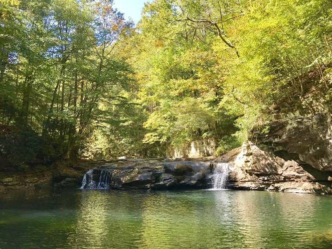
-
Bridge creek crossing
37.795586, -81.028503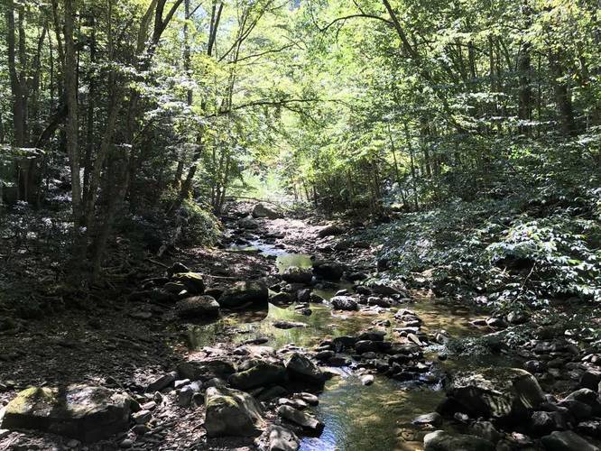
-
Campsite
37.807219, -81.015664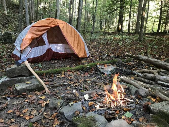
-
Cave carved by water - adjacent to Glade Creek
37.781278, -81.030364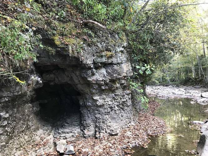
-
Kate's Falls - dried up in late Sept
37.775294, -81.031331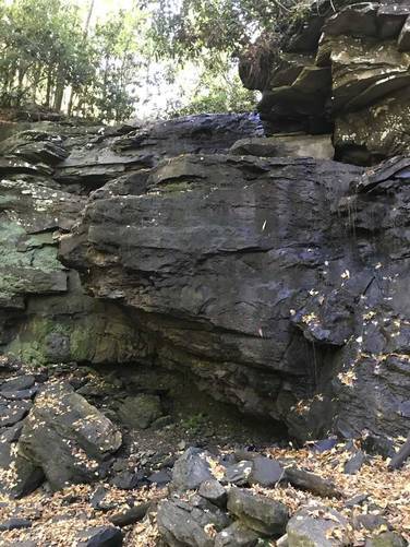
Hazards
Seasons
All
1 Trip Report


Helpful Links
Find Hiking Trails Near Me:


")


Before you leave...
MyHikes is an indie web platform aimed to make exploring public trails easier for everyone. The site has no investors and is owned and operated by one person, Dave Miller (Founder & Admin). As the Founder, main contributor, and doer-of-all-things for MyHikes, I share my trips with over-detailed write-ups for fun on a volunteer basis and I believe that public trail information should be available to everyone.
It takes a lot of time 🕦, money 💰, and effort (including espresso shots ☕) to run MyHikes, including hiking , mapping , writing , and publishing new trails with high-quality content... along with building new features, moderating, site maintainance, and app development for iOS and Android . I simply ask that if you find MyHikes' trail guides helpful to please consider becoming a Supporter to help keep the site, iOS, and Android apps available to everyone.
Supporters unlock website and in-app perks with a one-time payment of $25 (you renew) 😎👍. Or you can simply make a Donation of your choice without a MyHikes user account. Otherwise, telling your friends about MyHikes is the next-best thing - both quick and free 🎉
Thanks for visiting MyHikes and have a great hike!️

Dave Miller
MyHikes Founder & Admin

