Bradema Trail
Distance:
1.0 Mile / 1.6 kmType:
One-WayDifficulty:
ModerateTime to Hike:
~30 minutesFeatures:
Surface Type:
DirtLoading...
Loading...
The Bradema Trail at Frick Park in Pittsburgh. Pennsylvania is an easy-to-moderate 1 mile one-way trail that connects the Nature Trail to the Tranquil Trail and thus acts as a way to head down into the lower section of the park.
This trail is an easy hike if heading west to east since it's downhill the entire hike; however, during the wetter months, this trail can be muddy closer to the eastern side and the switchbacks area. If you're hiking this east to west, the trail is more of a moderate hike considering the elevation gain heading up the hill initially.
This trail does not have much to offer, but is lightly-trafficked and sits above the Falls Ravine Trail, so if the leaves are off of the trees, you get a birds-eye view of that ravine in the park.
Parking
Hikers will find parking at the coordinates provided which leads to the main entrance for Frick Park.
Pets
Dogs are allowed if leashed and their waste must be carried out by the hiker.
Biking
Biking is permitted along this trail.
Hazards
Seasons
All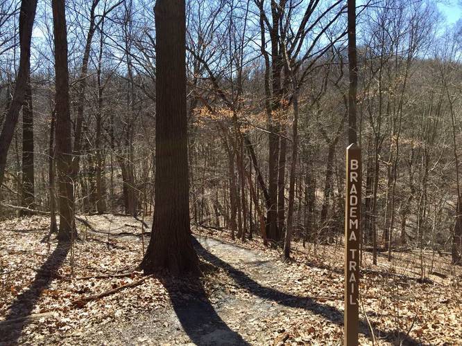
1 Trip Report


Helpful Links
Find Hiking Trails Near Me:


Before you leave...
MyHikes is an indie web platform aimed to make exploring public trails easier for everyone. The site has no investors and is owned and operated by one person, Dave Miller (Founder & Admin). As the Founder, main contributor, and doer-of-all-things for MyHikes, I share my trips with over-detailed write-ups for fun on a volunteer basis and I believe that public trail information should be available to everyone.
It takes a lot of time 🕦, money 💰, and effort (including espresso shots ☕) to run MyHikes, including hiking , mapping , writing , and publishing new trails with high-quality content... along with building new features, moderating, site maintainance, and app development for iOS and Android . I simply ask that if you find MyHikes' trail guides helpful to please consider becoming a Supporter to help keep the site, iOS, and Android apps available to everyone.
Supporters unlock website and in-app perks with a one-time payment of $25 (you renew) 😎👍. Or you can simply make a Donation of your choice without a MyHikes user account. Otherwise, telling your friends about MyHikes is the next-best thing - both quick and free 🎉
Thanks for visiting MyHikes and have a great hike!️

Dave Miller
MyHikes Founder & Admin

