Emily Lane Mt Holyoke Entrance
Distance:
1.1 Miles / 1.8 kmType:
Out-and-BackDifficulty:
EasyTime to Hike:
~33 minutesFeatures:
Surface Type:
DirtLoading...
Loading...
The Emily Lane Mt Holyoke Entrance Trail in Belchertown, Massachusetts is an easy 0.2 to 1.1 mile out-and-back hike depending on the time of year. There is a small parking area, a very clear trail head, and the trail runs for about 30 yards before stopping at a beaver dam during warmer months. During the winter, if the weather has been cold enough for the ponds to freeze, this is an easy 1.1 mile out-and-back hike and technically leads into the far eastern section of the Mount Holyoke Range State Park.
I found this spot on the Belchertown Conservation site saying there was
parking and access to Mount Holyoke Range State Park. I had previously
mapped a trail that is close by and assumed that there would be the connection from this trail.
We hiked this in mid January, so luckily the dam and ponds were frozen over, so we continued across the dam to a the beaver pond to the other side. There did not appear to be any clear trail head to resume on. We followed the tracks and cut straight through some pine trees to a trail maybe 50 yards from where we left the pond. From here we proceeded West/Southwest until the trail ended then turned back the way we came. The trail did indeed connect at the bridge located on the Bay Rd Trail. I do not believe this to be a viable trail or entrance to the Mount Holyoke Range, the distance seems about the same to bridge as the Bay Rd Trail entrance.
Hazards
Seasons
All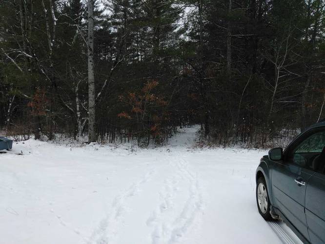
1 Trip Report


Helpful Links
Find Hiking Trails Near Me:


")


Before you leave...
MyHikes is an indie web platform aimed to make exploring public trails easier for everyone. The site has no investors and is owned and operated by one person, Dave Miller (Founder & Admin). As the Founder, main contributor, and doer-of-all-things for MyHikes, I share my trips with over-detailed write-ups for fun on a volunteer basis and I believe that public trail information should be available to everyone.
It takes a lot of time 🕦, money 💰, and effort (including espresso shots ☕) to run MyHikes, including hiking , mapping , writing , and publishing new trails with high-quality content... along with building new features, moderating, site maintainance, and app development for iOS and Android . I simply ask that if you find MyHikes' trail guides helpful to please consider becoming a Supporter to help keep the site, iOS, and Android apps available to everyone.
Supporters unlock website and in-app perks with a one-time payment of $25 (you renew) 😎👍. Or you can simply make a Donation of your choice without a MyHikes user account. Otherwise, telling your friends about MyHikes is the next-best thing - both quick and free 🎉
Thanks for visiting MyHikes and have a great hike!️

Dave Miller
MyHikes Founder & Admin

