Bray Trail - Inner Loop
Distance:
0.9 Miles / 1.4 kmType:
LoopDifficulty:
EasyTime to Hike:
~27 minutesFeatures:
Surface Type:
DirtLoading...
Loading...
The inner loop around Lake Bray is a 0.8 mile loop hike located within the Mount Tom State Reservation in Holyoke, Massachusetts. This trail consists partly of the Universal Access Trail and the Bray Loop Trail. The Universal Access Trail portion is several feet wide and covered in gravel with several wooden lookouts over the Lake Bray. The Bray Loop trail is filled with roots and rocks but very manageable since the terrain is overall very flat.
Explore 204 trails near Holyoke, MAHazards
Seasons
All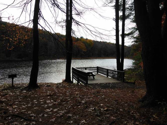
1 Trip Report


Helpful Links
Find Hiking Trails Near Me:


Before you leave...
MyHikes is an indie web platform aimed to make exploring public trails easier for everyone. The site has no investors and is owned and operated by one person, Dave Miller (Founder & Admin). As the Founder, main contributor, and doer-of-all-things for MyHikes, I share my trips with over-detailed write-ups for fun on a volunteer basis and I believe that public trail information should be available to everyone.
It takes a lot of time 🕦, money 💰, and effort (including espresso shots ☕) to run MyHikes, including hiking , mapping , writing , and publishing new trails with high-quality content... along with building new features, moderating, site maintainance, and app development for iOS and Android . I simply ask that if you find MyHikes' trail guides helpful to please consider becoming a Supporter to help keep the site, iOS, and Android apps available to everyone.
Supporters unlock website and in-app perks with a one-time payment of $25 (you renew) 😎👍. Or you can simply make a Donation of your choice without a MyHikes user account. Otherwise, telling your friends about MyHikes is the next-best thing - both quick and free 🎉
Thanks for visiting MyHikes and have a great hike!️

Dave Miller
MyHikes Founder & Admin

