Portland Japanese Garden Loop
Distance:
0.6 Miles / 1.0 kmType:
LoopDifficulty:
EasyTime to Hike:
~18 minutesFeatures:
Surface Type:
DirtLoading...
Loading...
The Portland Oregon Japanese Garden loop is a short 0.7 mile walk through one of Portland's most unique parks. Throughout the walk you'll find a 250 year-old bonsai tree (and other bonsai's), a natural garden with small waterfalls, a strolling pond garden with a large waterfall and Koi fish, a tea house, and amazing views of downtown Portland and Mount Hood in the background, which resembles Mount Fuji.
Depending on the time of the year, the garden can be very heavily trafficked. Mid-week during the shoulder seasons is not very busy at all and feels secluded. This is likely one of the best sights in Portland and well worth the visit.
GPS Data: The GPS data for this loop starts at the main courtyard where the paths start to split and then ends in the same area. It's missing the data from the parking lot entrance up to the main courtyard.
Admissions fee: There is an entrance fee to the garden, which may change from time to time. For more information on admissions, check out the Japanese Garden website.
Seasons
All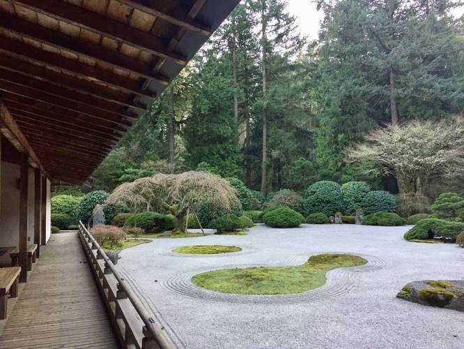
1 Trip Report


Helpful Links
Find Hiking Trails Near Me:


Before you leave...
MyHikes is an indie web platform aimed to make exploring public trails easier for everyone. The site has no investors and is owned and operated by one person, Dave Miller (Founder & Admin). As the Founder, main contributor, and doer-of-all-things for MyHikes, I share my trips with over-detailed write-ups for fun on a volunteer basis and I believe that public trail information should be available to everyone.
It takes a lot of time 🕦, money 💰, and effort (including espresso shots ☕) to run MyHikes, including hiking , mapping , writing , and publishing new trails with high-quality content... along with building new features, moderating, site maintainance, and app development for iOS and Android . I simply ask that if you find MyHikes' trail guides helpful to please consider becoming a Supporter to help keep the site, iOS, and Android apps available to everyone.
Supporters unlock website and in-app perks with a one-time payment of $25 (you renew) 😎👍. Or you can simply make a Donation of your choice without a MyHikes user account. Otherwise, telling your friends about MyHikes is the next-best thing - both quick and free 🎉
Thanks for visiting MyHikes and have a great hike!️

Dave Miller
MyHikes Founder & Admin

