Fisherman's Walk Trail
Distance:
0.8 Miles / 1.3 kmType:
Out-and-BackDifficulty:
EasyTime to Hike:
~24 minutesFeatures:
Surface Type:
DirtLoading...
Loading...
Fisherman's Walk is a small 0.8 mile out-and-back trail that leads from the Wiggly Bridge/Steedman Woods Trail over to York Harbor Beach and the Cliff Walk Trail.
The trail leads along the York River with waterside views. Occasionally the trail crosses a street, so be on the lookout for where the trail continues. Once you make it to the western side of the York Harbor Beach area, you've reached the end.
Additional hikes: If you plan to visit this trail, be sure to check out the Wiggly Bridge Trail, just across the street. You can also link up with the Cliff Walk Trail for a longer and even more scenic hike found after the southeast trailhead along this trail.
Parking: You can park at the same parking area for the Wiggly Bridge and walk over or you can park directly on Barrell Ln Exd Rd. If you plan to park near York Harbor Beach, be sure to read the signs about permit parking along Harbor Beach Road - you're better off parking on York Street.
Pets: Dogs are allowed if on leash and their waste must be carried out. Please note that dogs are not allowed on the Cliff Walk Trail, so if you plan to hit both, do not take your pup.
Hazards
Season
Summer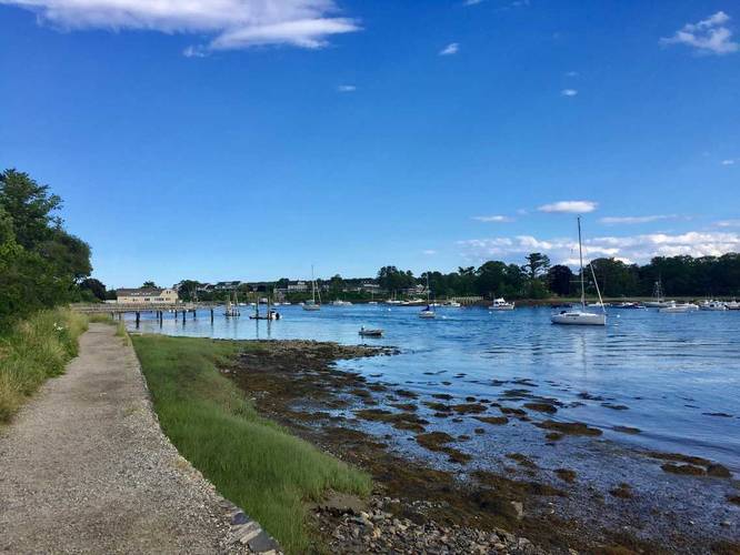
3 Trip Reports


Helpful Links
Find Hiking Trails Near Me:


Before you leave...
MyHikes is an indie web platform aimed to make exploring public trails easier for everyone. The site has no investors and is owned and operated by one person, Dave Miller (Founder & Admin). As the Founder, main contributor, and doer-of-all-things for MyHikes, I share my trips with over-detailed write-ups for fun on a volunteer basis and I believe that public trail information should be available to everyone.
It takes a lot of time 🕦, money 💰, and effort (including espresso shots ☕) to run MyHikes, including hiking , mapping , writing , and publishing new trails with high-quality content... along with building new features, moderating, site maintainance, and app development for iOS and Android . I simply ask that if you find MyHikes' trail guides helpful to please consider becoming a Supporter to help keep the site, iOS, and Android apps available to everyone.
Supporters unlock website and in-app perks with a one-time payment of $25 (you renew) 😎👍. Or you can simply make a Donation of your choice without a MyHikes user account. Otherwise, telling your friends about MyHikes is the next-best thing - both quick and free 🎉
Thanks for visiting MyHikes and have a great hike!️

Dave Miller
MyHikes Founder & Admin

