Brittlebank Park Pier Trail
Distance:
0.2 Miles / 0.3 kmType:
Out-and-BackDifficulty:
EasyTime to Hike:
~6 minutesFeatures:
Surface Type:
Universal AccessLoading...
Loading...
The Brittlebank Park Pier Trail in Charleston, South Carolina is an easy universally accessible pathway that leads to the end of a pier with views located on the Ashley River.
This is not a hike but rather a very short out-and-back walk along a paved and boardwalk path. Visitors will find benches and views from the end of the trail which also provides a roof for shade.
Parking
Visitors will find a medium-sized parking lot at the coordinates provided, located on the south side of Lockwood Drive at Brittlebank Park. The lot is large enough to fit just under a dozen vehicles. There are additional parking lots located near the entrance to the park; however, there's no universally-accessible connecting path to this one and walkers must connect through the open grassy area.
Pets
Dogs are allowed if leashed and must be cleaned up after.
-
Parking
32.789028, -79.961532 -
Main Trailhead
32.789046, -79.961743 -
Marshland along the Ashley River
32.788228, -79.963189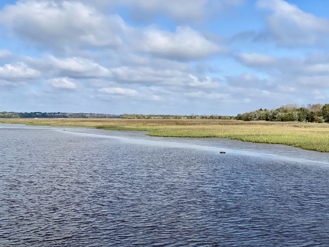
Seasons
All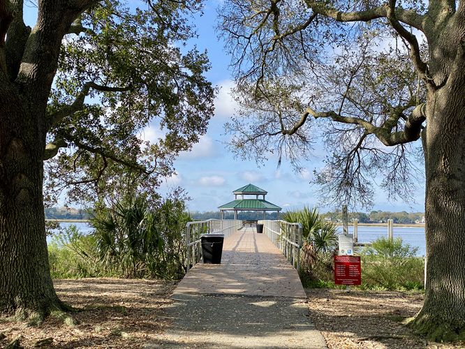
1 Trip Report


Helpful Links
Find Hiking Trails Near Me:


Before you leave...
MyHikes is an indie web platform aimed to make exploring public trails easier for everyone. The site has no investors and is owned and operated by one person, Dave Miller (Founder & Admin). As the Founder, main contributor, and doer-of-all-things for MyHikes, I share my trips with over-detailed write-ups for fun on a volunteer basis and I believe that public trail information should be available to everyone.
It takes a lot of time 🕦, money 💰, and effort (including espresso shots ☕) to run MyHikes, including hiking , mapping , writing , and publishing new trails with high-quality content... along with building new features, moderating, site maintainance, and app development for iOS and Android . I simply ask that if you find MyHikes' trail guides helpful to please consider becoming a Supporter to help keep the site, iOS, and Android apps available to everyone.
Supporters unlock website and in-app perks with a one-time payment of $25 (you renew) 😎👍. Or you can simply make a Donation of your choice without a MyHikes user account. Otherwise, telling your friends about MyHikes is the next-best thing - both quick and free 🎉
Thanks for visiting MyHikes and have a great hike!️

Dave Miller
MyHikes Founder & Admin

